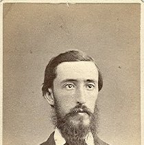
Person Record
Metadata
Name |
Berry, William J. |
Occupation |
City Engineer |
Role |
Construction |
Related Records
-
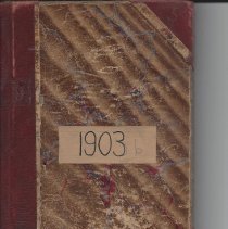
011.023.007 - Book
Book with records of Field Surveys for the City of Beverly labelled 1903b on front. Book is bound with a faded brown cover. Inside the front cover the name "Charles A. Colson City Engineer Dept., Beverly, Mass " is written followed by the date November 18, 1903. Under his name it is also annotated "W. E. Gardner Survey Mingoe Beach Beverly Cove Beverly Mass." and then "William J. Berry 153 Cabot St, Beverly Mass." There are some mathe...
Record Type: Archive
-
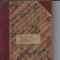
011.023.009 - Book
Book with records of Field Surveys for the City of Beverly labelled 1905 on front. Book is bound with a faded brown cover. There is no name listed in this book so we do not know to whom this book belonged. Writing is similar to others. There are some mathematical notations inside both front and back covers. Although most of the pages were written primarily in pencil/lead/graphite they are not as faded as 011.023.001 so they are still very...
Record Type: Archive
-
-
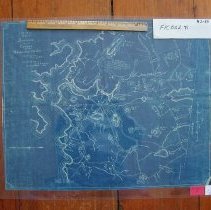
FIC002.091 - map
1897 map of Beverly, showing boundaries of Frost Fish Brook, Wenham, Atlantic Ocean, Wooleston River. It gives the names of many property owners, dates and place names.
Record Type: Archive
-
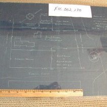
FIC002.180 - Plan
1891 survey of the downtown area surrounded by Thorndike Street, Endicott Street and Abbott Street. It was mapped by surveyor William J. Berry.
Record Type: Archive
-
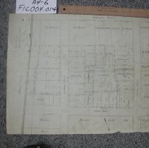
FIC004.014 - Plan
Shows lots of property on Lothrop, Abbott, Lovett and Washington Sts.
Record Type: Archive
-
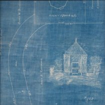
FIC.2017.408.001 - Blueprint
Blueprint of the Powder House Lot. Created by William J. Berry, City Engineer.
Record Type: Archive