Search Term Record
Metadata
Name |
Alford's Hill |
Related Records
-
997.1.8 - map
This is a map of Ryalside, Beverly which was part of Salem in 1700.
Record Type: Archive
-
FIC002.091 - map
1897 map of Beverly, showing boundaries of Frost Fish Brook, Wenham, Atlantic Ocean, Wooleston River. It gives the names of many property owners, dates and place names.
Record Type: Archive
-
-
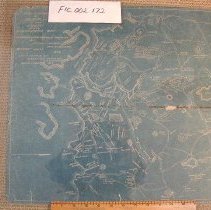
FIC002.172 - map
Plan of a part of Beverly in the Colony of Massachusetts Bay. Originated in 1897 and revised in 1927.
Record Type: Archive
-
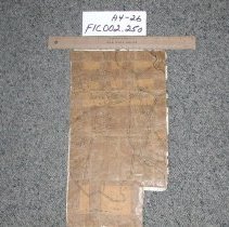
FIC002.250 - Plan
Shows properties and grant dates for an area of North Beverly
Record Type: Archive