Search Term Record
Metadata
Name |
Mackerel Cove |
Related Records
-
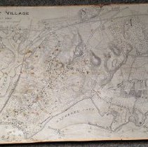
008.049.001 - Map
A map of Beverly Village drawn about 1848 from the office of the City Engineer. Topographic information, water depth and the location of structures and wharves are provided. The Eastern Railroad and bridge are also present. Beverly Creek, Porter's Rock, Tuck's Point, Mackerel Cove, Hospital Point Light, Woodberry's Point, Mingo's Brach and Curtis Point are all identified.
Record Type: Archive
-
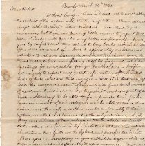
948.001.263 - Letter
A letter from Robert Rantoul to his son, Robert Rantoul Jr., while he was a student at Phillips Academy in 1820. It contains news from Beverly, including reports on the health of family members and stories of a religious revival taking place in parts of Beverly, including Mackerel Cove, the Farms, and Montserrat.
Record Type: Archive
-
-
FIC002.091 - map
1897 map of Beverly, showing boundaries of Frost Fish Brook, Wenham, Atlantic Ocean, Wooleston River. It gives the names of many property owners, dates and place names.
Record Type: Archive
-
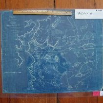
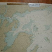
FIC002.123 - map
Provisional Chart of the United States - East Coast Massachusetts, Salem, Marblehead and Beverly Harbors created in 1984.
Record Type: Archive
-
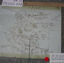
FIC002.228 - Plan
Plan of the common lands in 1850 and their proprietorship by names.
Record Type: Archive