Search Term Record
Metadata
Name |
Map |
Related Records
-
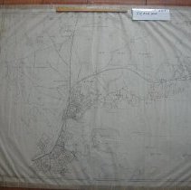
001.23.1 - Map
Undated map of Beverly business directory showing merchants, dealers, and manufacturers from Gloucester Crossing to the Beverly/Salem bridge.
Record Type: Archive
-
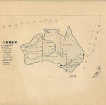
007.064.039 - Map
Hand-drawn map of Australia, by Charles C. Elwell. Graded 'a' in red pencil. Map is 5" x 8" on 9" x 12" sheet. List on back: Melbourne, Sydney, Brisbane, Adelaide, Darwin, Perth, Albany, Auckland, Wellington, Rivers, Murray, Darling.
Record Type: Archive
-
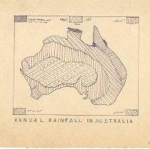
007.064.040 - Map
Hand-drawn map of "Annual Rainfall in Australia" by Charles Elwell. Graded "a" in red on right. Map is 4 1/4" x 5" on 6" x 8 3/4" page. Signed by C. Elwell in bottom right corner.
Record Type: Archive
-
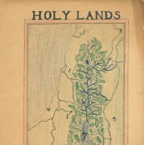
007.064.042 - Map
Map of the Holy Lands drawn and colored by Edward C. ______(? the last name was on a missing corner that was gone when this was catologued). Drawn on 9" x 12" page. Grade 8.
Record Type: Archive
-
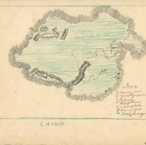
007.064.043 - Map
Hand-drawn and colored map of China, by Charles Elwell. Graded "B". On 9" x 12" page.
Record Type: Archive
-
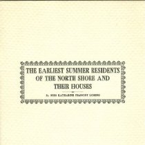
009.001.031 - Book
Booklet entitled "The Earliest Summer Residents of the North Shore and Their Houses" by Katharine P. Loring, who was the President of the Beverly Historical Society at the time of publication in 1932. The booklet is a reprint from The Essex Institute Historical Collections, volume LXVIII (v. 68). The Essex Institute is now known as the Peabody Essex Museum. It was contributed written for the Beverly Historical Society. The cover and pages are ...
Record Type: Archive
-
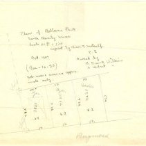
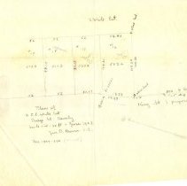
009.057.059 - Map, plan
Handwritten plan of "Bellevue Park" in North Beverly, MA. The writing on the map indicates that it was copied by Charles A. Metcalf in October, 1907. According to the map, properties were owned by B. Frank Wilkins, S. Herbert Wilkins, as well as families by the names of Ayers and Hackett. There is no Bellevue Park in present day Beverly, nor do atlases of the time indicate a Bellevue Park in the area of Raymond Street (see map). It is possi...
Record Type: Archive
-
009.057.060 - Map, plan
Handwritten plan/map of proposed King Street (now known as King Terrace). On the map, dated June, 1907, it states "Plan of O.C.E. White Est." It also names the S. White Estate at the top of the plan. According to the map families by the names of Ayers and Hackett owned pieces of property along (proposed) King Street.
Record Type: Archive
-
10998 - Map
This is a copy of a map drawn by Osgood Carleton about 1790. This is in relation to navigation.
Record Type: Archive
-
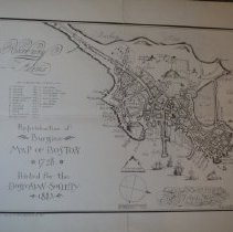
4744 - Map
This is a reproduction of Burgiss a map of Boston from 1728. This was printed for the Bostonian Society in 1885.
Record Type: Archive
-
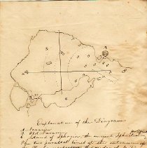
948.001.301 - Map, plan
A hand-drawn diagram of the battle of Navarino in Greece, including a map of the island of Sphagia and lines representing the position of the Turkish, British, Russian, and French forces. Found placed in 948.001.294.
Record Type: Archive
-
-
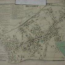
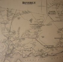
988.508.19 - Map
Map of Beverly- scale 2.5" to the mile. 1872. Shows bodies of water, streets, hills and different sections of the town in black and white. 17" x 14"
Record Type: Archive
-
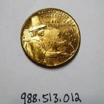
988.513.012 - Coin, Commemorative
Circular, gold colored commemorative coin honoring the 300th anniversary of Massachusetts Bay Colony. There is an early settler, possibly a Puritan, with his hands reaching out featured on the coin. Behind the settler is a map of Massachusetts. Embossed on the top of the medal is "Tercentenary of Massachusetts Bay Colony in New England 1630 1930." On the reverse of the medal is "Souvenir" embossed on the top, with a fish depicted below it. "Mass...
Record Type: Object
-
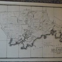
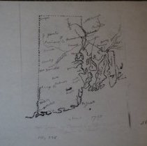
991.49.3 - Map
This is a map of the town of Manchester from the latest survey. Elevations are included to show above mean water level. Thsi shows the borders with Beverly, Gloucester, Essex, Hamilton, and Wenham.
Record Type: Archive
-
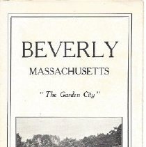
993.50.5 - Brochure
An undated brochure "Beverly, Massachusetts The Garden City" published by the Chamber of Commerce for tourists, it consists of a map of Essex County and lists places of interest in Beverly
Record Type: Archive
-
997.6.3a - Chart, Navigational
This is a chart of Boston Harbor from the U.S. Coast Survey from 1860.
Record Type: Archive
-
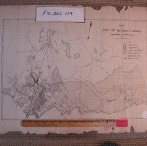
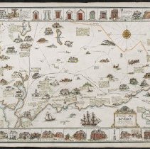
FIC002.029 - Map
1934 illustrated map of Beverly showing points of interest, historical sites with drawings of these sites around the edge of the map.
Record Type: Archive
-
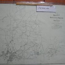
FIC002.030 - Map
1917 map from the Beverly City Directory showing wards, summer residents with private streets, and street car lines.
Record Type: Archive
-
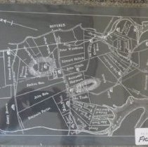
FIC002.040 - Map
1885 map of Beverly showing districts and individual buildings.
Record Type: Archive